Mapping in the field
Nov 3, 2015
The outputs of our camera system allow us to create elevation models and mapping products. We’ve been doing some of this whilst we’ve been here to support field teams.
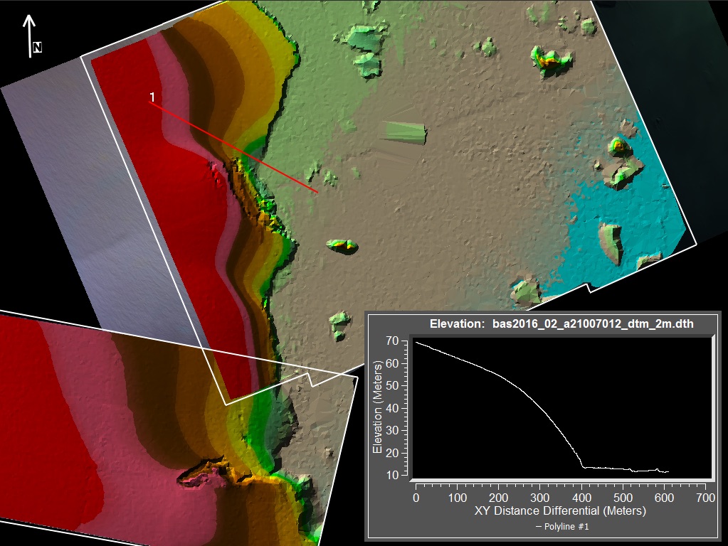
Based on the data we collected during the Emperor Penguin Hunt, I’ve been generating some useful information for the team heading over to the colony. The team will be attaching trackers to the Emperor Penguins to see where they travel. The colony is around 500 metres away from the coast on sea ice which is believed to be sufficiently thick enough to allow human travel. The team wished to know if it was possible to camp on the island and travel onto the sea ice safely in order to visit the penguins.
The good news is, it seems there is a possible ramp the field team will be able to travel down from the island.